Thanks for being here and welcome to our first ever newsletter! TrekFreely is built by backcountry adventurers, for the backcountry adventurers heading out into the field and the emergency contacts staying behind. We're putting together the tools and resources we wish we'd had when we started, and sharing them as fast as we can build them.
On the first of each month, this newsletter will hit your inbox with a short update on what's new on the site, what we're working on, and any other TrekFreely news that's worth your while.
One thing worth saying up front, since this is issue one: The resources and safety tools TrekFreely provides are, and will always be, free. No ads, no paywall, no data selling. Safety resources stop being safety resources the moment you put them behind a paywall. That's the contract.
New on the blog
The first post — Who We Are and Why We Built TrekFreely — is live. It walks through the founding pattern that led to this project: the scattered-information problem that every backcountry adventurer eventually hits when they try to keep the people at home in the loop. If you haven't read it yet, that's the right place to start.
And just yesterday — The Trip Starts at Home went live. It's about trip planning as the work done at home before the trip starts: five principles covering what good preparation is actually for, and why the kitchen-table hour matters more than what's in your pack.
New posts go up roughly every two weeks — trip planning, safety, gear, field skills, whatever is worth writing about. We will also post on our social accounts when new posts drop so be sure to follow us on Instagram and Facebook!
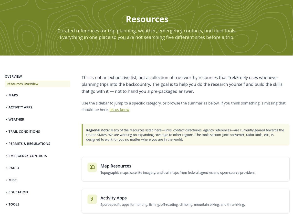
Resources: planning tools for the trail
The Resources hub is what you reach for before a trip — a curated set of trusted references for maps, weather, conditions, permits, emergency contacts, and field tools. We didn't invent any of this. What we did was put it in one place with enough context that you know which one to use and when.
The pieces worth knowing about first:
- The Search and Rescue and emergency contact directory - Lots of people have no idea their county has a Search and Rescue coordinator, let alone how to reach them. Find yours before the next trip.
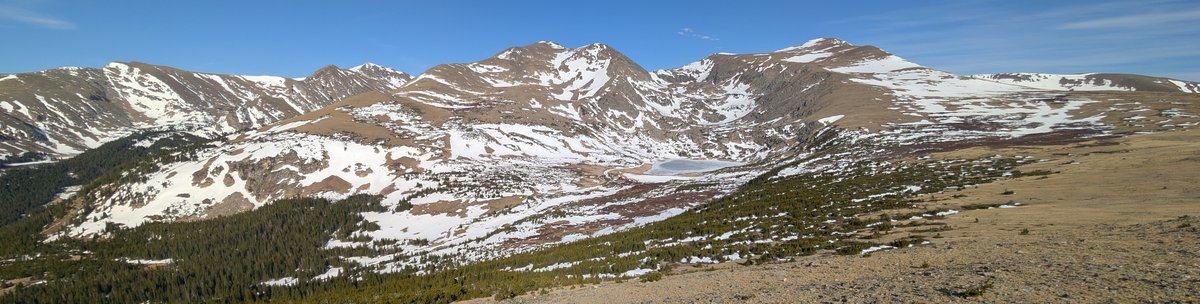
- The weather section - The forecast at the trailhead tells you almost nothing about conditions at elevation. We break down the authoritative sources and what each one is actually good for.
- The mapping section - Topo maps, satellite imagery, route planning tools — with notes on when to reach for which.
There's more in the hub — activity-specific apps, permits and regulations, trail and road conditions, radio references, field tools, and recommended reading. Worth a bookmark.
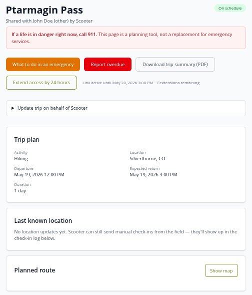
The Trip Portfolio: one place for the people staying behind
When you head out on a trip, the people at home end up stitching trip information together from four different places — a device share link here, a route PDF there, a text with the trailhead name, a sticky note on the kitchen counter. None of it lives in one place. None of it updates on its own. And when something looks wrong, none of it is in a format they can hand to a responder.
The Trip Portfolio is the fix. You build the trip once: route, vehicle, gear, medical, emergency contacts, check-in schedule. You share a single link. Whoever you share it with opens it on any phone or laptop — no account, no app — and sees your trip status, your route on a map, your last check-in, and a clear walk-through of what to do if something looks off.
Live location tracking works today for Garmin inReach and SPOT. If you carry a Zoleo, you can share your device link from your portfolio. Full live tracking for Zoleo is something we're still investigating — we want to be sure it's actually possible from their platform before we commit to it.
Set up your first Trip Portfolio →
On the horizon
A few things we're working on, in rough priority order — no dates promised, but here's where we are focusing our attention:
- Sign in with Apple for account holders, so you don't have to remember another password.
- APRS live tracking for HAM operators running packet radio in the field.
- SMS alerts for trip notifications, so emergency contacts get a text when something changes.
- More safety tooling inside the shared portfolio — additional ways for the people at home to know what's normal and what isn't.
- A mobile app to make trip portfolio creation and management easier while on your mobile device.
We'll mention each of these here when they become available.
A note from the founder
I started TrekFreely because I kept hitting the same problem on my own trips, and waiting for someone else to fix it was no longer an option. The people reading this early are the ones whose feedback will actually shape what this becomes. If you have something to say — about what's here, what's missing, what works, what doesn't — the contact form routes directly to me.
If you want to support the project, you can donate or visit our online shop. Everything we build stays free either way.