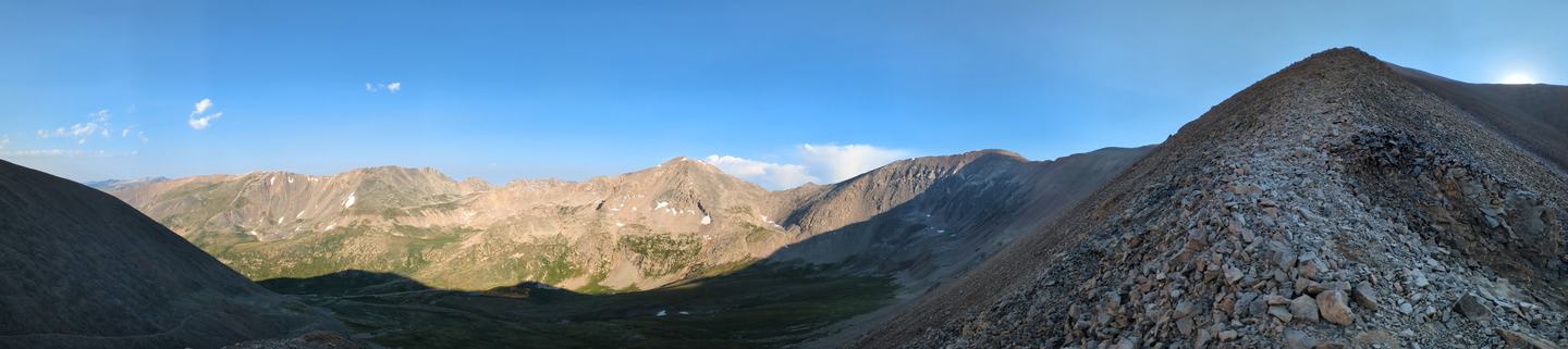
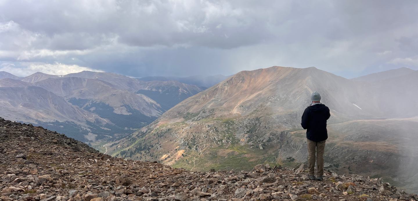
Somewhere between the trailhead and the first ridge, the noise drops away. No notifications. No decisions that can't wait. Just the weight of a pack, your own breathing, and the particular quiet that only exists where the road doesn't go.
That's why people go. Some of them want to test themselves, some want the summit, some want the miles — sure, all of that happens — but the deeper reason is simpler. The wilderness asks for your full attention, and gives something back when you pay it.
The backcountry doesn't care about your qualifications. It doesn't grade on effort or adjust for bad luck. Conditions change. Routes turn out harder than the map suggested, and a bluebird morning can go sideways by noon. None of these however, are a reason to stay home. It's a reason to be ready, and to make sure the people who care about you know where you are.
That tension, between the freedom of going out and the responsibility that comes with it, is where TrekFreely lives.
A problem with two bad solutions
If you've ever tried to prepare for a backcountry trip, you already know the first one. The information you need exists. Topo maps, weather forecasts, contact directories, permit systems, trail conditions — it's all out there. But it's scattered across a dozen places, half of it behind paywalls, almost none of it explained in a way that's useful to someone who doesn't already know what they're looking for.
Telling a first-time backcountry adventurer to "do their own research" tells them nothing. They don't know what a trip plan is. They've never heard of their county Search and Rescue (SAR) coordinator. They couldn't tell you the difference between a topo map and a trail map, or why that distinction matters. Dropping them at the edge of the internet and wishing them luck isn't helpfulness — it's abandonment with good intentions.
The opposite extreme is in some ways worse. A whole genre of outdoor content does the work for you: pre-built itineraries, GPS coordinate drops, curated campsites served up on a platter. It's popular because it's easy, and it produces adventurers who fall apart the moment conditions shift off-script. It also concentrates thousands of people onto the same small patches of wilderness, which is an environmental problem that compounds quietly until suddenly it doesn't.
Neither version is what we wanted to build.
There's a third kind of helpfulness — the kind that builds capability over time. That's the one we're interested in. Every resource on TrekFreely ships with enough context to actually be useful: what it is, when you'd reach for it, what skill it's helping you build. We want people who use this site to come back from a trip knowing more than when they left.
Why we built this
TrekFreely started with a pattern our founder kept hitting.
He'd do everything right on his end before a trip. Plan the route, note the trailhead, set up check-ins on a satellite communicator, write down who to call and when. And he'd come home to find that the person who was supposed to have all of that information had spent the trip stitching it together from four different places: a device share link here, a map PDF there, a text with the trailhead name, a sticky note on the kitchen counter. Sometimes the link had quietly stopped updating partway through.
The information existed. It just wasn't in one place, and the gap wasn't something a better app was going to solve. The individual tools were fine. The problem lived between them, in the empty space across platforms that had no reason to talk to each other.
The person waiting at home shouldn't have to be scrambling and searching across multiple places to find the information that matters. They need one place to look. And if something goes wrong, they need to be able to hand that information to the right people right then, without trying to remember which link goes where.
So we built that place. You can read more about how TrekFreely came together, and the people behind it, on our About page.
I had done everything right and still left my partner at home anxious because nothing was in one place. That is a failure of the ecosystem, not of her. We can fix it.
— Scott Taylor, Founder
Three things we believe
TrekFreely isn't a startup chasing a market. It's a response to a set of problems we've lived with long enough to want to do something about them. Before we get into what we've built, it's worth saying clearly what we believe, because everything we build follows from it.
Guided self-sufficiency
The goal is not to hand you the answer. It is to give you the tools to find it yourself — and make sure you know how to use them.
We give people the tools to find the answer themselves, not the answer itself. A backcountry adventurer who has learned to read a topo map, cross-reference a forecast, and build an honest trip plan will make better decisions in the field than one who has been led to the summit and back by a curated guide. We want to build the first kind of adventurer.
Every resource on TrekFreely comes with context: what this tool is, when you'd use it, what it's teaching you. We won't publish GPS coordinates for specific campsites. We won't build an itinerary generator that does the thinking for you. The wilderness rewards preparation, and preparation means actually learning something.
Genuine safety
We want people to come home. That carries something specific about how we think about Search and Rescue teams and first responders, who are mostly volunteers, train on their own time, and put themselves at risk every time they go out for someone who wasn't ready.
Every preventable rescue is a call that didn't have to go out. TrekFreely exists partly to reduce those calls — not by talking anyone out of going outside, but by making preparation accessible to everyone, regardless of experience level or budget. A well-prepared adventurer isn't only safer for themselves. They reduce the risk for the people who would come to find them.
Frictionless peace of mind for those left behind
The person waiting at home is part of every trip. They need one place to look, a clear picture of where you are and when to expect you back, and a straightforward answer to the question they're really asking: is this normal?
That's what TrekFreely is building. A single, shareable view of a trip that works for whoever receives it, regardless of their outdoor experience or technical background. Fragmented information doesn't just cause anxiety; in an actual emergency, it costs time the people responding don't have.
Start here
You don't have to wait for a product. Everything below is live right now, free, and built on the same philosophy: here's what this is, here's when you'd use it, here's what you're learning by using it.
The trip portfolio
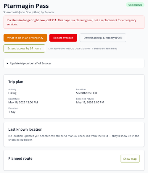
The trip portfolio is what we built to fix the scattered-information problem. One place where your route, vehicle, gear, medical information, emergency contacts, and check-in schedule live together. You build it once before your trip and the people you share it with get a link without needing an account or app to view it. They open the page and see your trip status, your route on a map, your last check-in, and a clear walkthrough of what to do if something looks wrong.
This is our first release. It does the core thing, does it well, and it does it for free. There's plenty more coming so be sure to sign up for our newsletter to stay informed of planned feature integrations and releases. If you want to check it out and put together your first portfolio, head to the Trip Portfolio page.
Resources worth knowing about
The resources section pulls together the references we actually use when planning a trip. Four worth knowing about:
- Mapping resources. A map is only useful if you can read it. The mapping section covers topographic maps from federal agencies, satellite imagery, route planning tools, and printable references, with enough context on each one to know when to reach for it.
- Weather resources. Weather at the trailhead tells you almost nothing about conditions at elevation. The weather section pulls together the authoritative sources: National Weather Service point forecasts, avalanche center advisories, fire weather, air quality, stream gauges, and explains what each one is actually good for.
- Emergency contacts. Most people have no idea their county has a Search and Rescue (SAR) coordinator, let alone how to reach them. This section explains how SAR works in the United States, when and how to call for help, and includes directories of SAR organizations, sheriff offices, and ranger stations by state. Look yours up before your next trip.
- Education and preparedness. The fundamentals: Leave No Trace principles, land stewardship, and wilderness preparedness. Written as accumulated knowledge from people who've spent a lot of time in the backcountry figuring out what actually works, and what leaves the land worse than they found it. Links to training providers, volunteer opportunities, and further reading included.
Beyond those four, the resources section also covers activity-specific app references for hiking, hunting, climbing, and more; trail and road conditions; permits and regulations for public lands; HAM and GMRS radio references; field tools including a unit converter and Maidenhead grid locator; and a section of podcasts and field reading worth your time. The full list lives on the Resources page.
This is just the start
TrekFreely is a nonprofit run by people who spend their own time in the backcountry and got tired of waiting for someone else to solve a problem they kept running into. No investors. No paid tier coming. The resources and trip portfolio tools are, and always will be, free, because safety resources stop being safety resources the moment you put them behind a paywall.
We at TrekFreely have much more planned, and there are partnerships we're working toward once we've earned the right to pursue them. We'll talk about all of that as it becomes real.
If you found something useful, send it to someone who's planning a trip. The SAR contact directory tends to matter most to people who've never heard of it. The mapping section is for anyone who's wanted to understand the land before setting foot on it. The trip portfolio is for anyone who's looking to make sure the people waiting at home have all the information they need when it matters most. Pass it along.
The wilderness belongs to anyone willing to show up prepared and leave it better than they found it.
Begin Your Adventure